


Bob Ward, Crittenden County, Arkansas
About
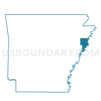
Outline

Summary
| Unique Area Identifier | 526310 |
| Name | Bob Ward |
| County | Crittenden County |
| State | Arkansas |
| Area (square miles) | 63.61 |
| Land Area (square miles) | 63.47 |
| Water Area (square miles) | 0.14 |
| % of Land Area | 99.78 |
| % of Water Area | 0.22 |
| Latitude of the Internal Point | 35.06269890 |
| Longtitude of the Internal Point | -90.35708620 |
Maps


Graphs
Select a template below for downloading or customizing gragh for Bob Ward, Crittenden County, Arkansas


Neighbors
Neighoring Voting District (by Name) Neighboring Voting District on the Map
- BLACKFISH PCT 7, St. Francis County, AR
- Edmondson Bob Ward 1, Crittenden County, AR
- GARLAND PCT 4, St. Francis County, AR
- HETH PCT 6, St. Francis County, AR
- Jackson 1 Voting District, Crittenden County, AR
- Jennette Voting District, Crittenden County, AR
- Lucas Voting District, Crittenden County, AR
- Memphis 50-1 Voting District, Shelby County, TN
- Mississippi TWP Voting District, Crittenden County, AR
- Protor Voting District, Crittenden County, AR
Top 10 Neighboring County Subdivision (by Population) Neighboring County Subdivision on the Map
- District 2, Shelby County, TN (181,269)
- Mississippi township, Crittenden County, AR (26,435)
- Tyronza township, Crittenden County, AR (3,088)
- Garland township, St. Francis County, AR (1,710)
- Jackson township, Crittenden County, AR (1,352)
- Bob Ward township, Crittenden County, AR (982)
- Proctor township, Crittenden County, AR (942)
- Lucas township, Crittenden County, AR (657)
- Heth township, St. Francis County, AR (576)
Top 10 Neighboring Place (by Population) Neighboring Place on the Map
Top 10 Neighboring Unified School District (by Population) Neighboring Unified School District on the Map
- Shelby County School District, TN (280,755)
- West Memphis School District, AR (25,528)
- Marion School District, AR (20,110)
- Earle School District, AR (3,179)
- Hughes School District, AR (3,154)
Top 10 Neighboring State Legislative District Lower Chamber (by Population) Neighboring State Legislative District Lower Chamber on the Map
- State House District 86, TN (54,462)
- State House District 53, AR (28,946)
- State House District 52, AR (24,057)
- State House District 54, AR (21,956)
Top 10 Neighboring State Legislative District Upper Chamber (by Population) Neighboring State Legislative District Upper Chamber on the Map
- State Senate District 33, TN (179,193)
- State Senate District 17, AR (71,695)
- State Senate District 16, AR (68,732)
Top 10 Neighboring 111th Congressional District (by Population) Neighboring 111th Congressional District on the Map
Top 10 Neighboring Census Tract (by Population) Neighboring Census Tract on the Map
- Census Tract 306, Crittenden County, AR (4,875)
- Census Tract 9601, St. Francis County, AR (3,136)
- Census Tract 307.03, Crittenden County, AR (2,285)
- Census Tract 310, Crittenden County, AR (1,406)
- Census Tract 9803, Shelby County, TN (0)
Top 10 Neighboring 5-Digit ZIP Code Tabulation Area (by Population) Neighboring 5-Digit ZIP Code Tabulation Area on the Map
- 38109, TN (46,594)
- 72364, AR (15,831)
- 72348, AR (2,594)
- 72376, AR (1,977)
- 72327, AR (1,732)
- 72346, AR (697)